downloads: https://github.com/IR0NSIGHT/Puddler/releases
github: https://github.com/IR0NSIGHT/Puddler

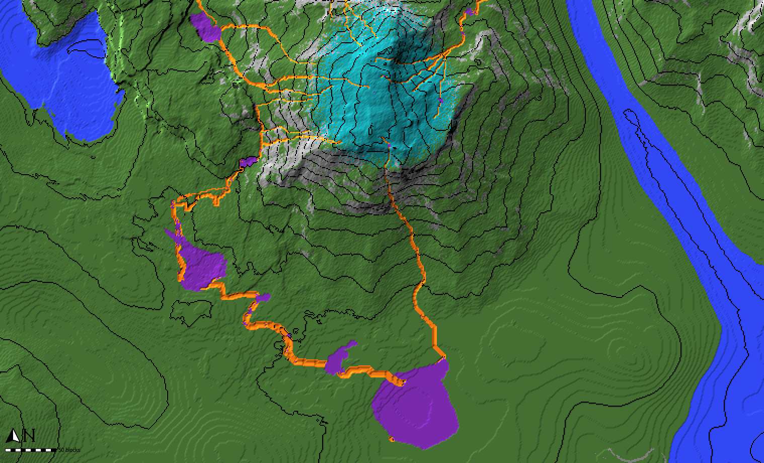
Worldpainter script that creates small rivers and ponds across the map
downloads: https://github.com/IR0NSIGHT/Puddler/releases
github: https://github.com/IR0NSIGHT/Puddler
planetMc: https://www.planetminecraft.com/mod/puddler-js-worldpainter-script/
| 1 | 1 |
|---|---|
 |
 |
 |
 |
- download the newest release as a zip file puddler.js file
- unpack the zip folder somewhere
- mark all the spots where rivers can start in your worldpainter world with the CYAN annotation layer. Be generous, a 100×100 area is fine
- in WorldPainter, on the top toolbar, center-right, open “run script” and select Puddler.js from the folder where you unpacked the zip file
- Select your wanted parameters and run the script. Check “use Annotations” to get a preview of the rivers.
- Inspect if you like the rivers and puddles (lakes)
- Undo the script with ctrl + z
- Edit the terrain, to control where the water flows and where lakes form
- Repeat steps 5-8 until you are satisfied
- Run the script a final time with “flood Puddles” and “apply Rivers” checked to apply water
- Export the map to minecraft
- Max Puddle Surface: Lakes will stop growing if they reach this surface area and will not overflow and spawn new rivers. Smaller value: smaller lakes, rivers might not reach ocean
- Minimal River Length: Dont apply rivers that are shorter than this
- Spawn Probability: Chance for a river to spawn at a cyan annotated block.
- 1000 = 1 block for 1000 cyan blocks will spawn a river.
- 1 = 1 block for 1 cyan block will spawn a river
- Flood Puddles: Puddles (Lakes) will be filled with water
- Apply Rivers: Rivers will be filled with water
- Apply as Annotations: Rivers and Puddles will be annotated in Orange and Purple
- Ocean Water Leve: Rivers will stop once they reach this height. Should match your ocean level.